Realigning a Road Network in a New Game Reserve
Realigning a Road Network in a New Game Reserve
Who is Singita?
Singita is a conservation company that uses high-end photographic tourism to support the funding of conservation initiatives in five regions across four countries in Africa. Singita is also a partner in the development of Karingani Game Reserve, a new conservation area in Mozambique, adjacent to South Africa’s Kruger National Park.
The Goal
Karingani Game Reserve’s Vision is to restore, enhance and maintain the natural ecological processes and biodiversity of the land through an effective and sustainable partnership between the Mozambican government, private investors and participating communities. As much of this land was historically used for low intensity agriculture and/or grazing for cattle, much investment is being put into the rehabilitation of the natural systems and associated vegetation. One of the problems the reserve faces is that the existing road network was developed without any thought to geology or topography, which has led to significant erosion of the landscape in these areas.
The Challenge
This will involve closing some existing roads and opening up new roads in their place. The most important consideration in this project is the topography of the land and the effect thereof on water flow, as this is the primary driver of road erosion. In the early stages of the road alignment project, the focus is on management and security roads, and does not take into account aspects such as wildlife distribution, a factor that will be important when developing game-viewing loops at a later stage.
The Solution
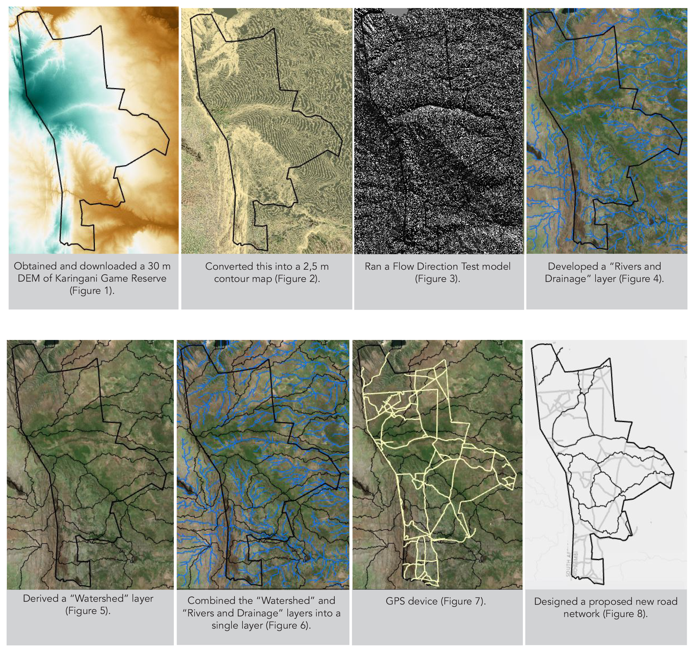
The final step in the process will be the collection of further field data to ensure that the proposed realignment is feasible on the ground, and does not run through any ecologically sensitive zones.
To learn more about Singita email: [email protected]
The Challenge
– Karingani’s management has undertaken to realign the road network to minimise both future ecological damage and the costs of maintaining the road network.
The Solution
– In order to determine which roads should be closed and where to open new roads to ensure necessary access to the reserve is maintained, Karingani’s management used ArcGIS Pro analytical tools.
Benefits
– Without GIS, this project would have taken significantly longer and the cost would have been exorbitant. By using ArcGIS Pro, the management team was able to make informed decisions that will ensure that Karingani’s road network is functional, cost effective and environmentally sensitive.